NEARBY ATTRACTIONS
Get ready for lots of fun and excitement! Wyoming has some breathtaking attractions and landmarks that nature has provided this down-to-earth little town.
|
|
|
HISTORICAL
ML Ranch Caroline Lockhart Ranch Hillsboro Bad Pass Trail Medicine Wheel |
RECREATION AREAS
Big Horn Canyon National Recreation Area Yellowtail Habitat Devil's Canyon Big Horn Lake Pryor Mountains Big Horn Mountains |
|
SCENIC DRIVES/TRAILS
Big Horn Scenic Byway Big Horn Mountains Porcupine Falls Trail Bucking Mule Falls Trail Five Springs Falls Trail Pryor Mountains Wild Horse Range |
SPORTSMEN
Big Game & Bird Hunting Fishing Snowmobiling Cycling/Hiking Boating Camping Golfing |
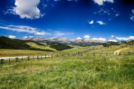
Year-round recreation opportunities keep anyone active. The Big Horn and Pryor Mountains are only 20 minutes away. Yellowstone Park is a beautiful two hour drive to reach the entrance. Bighorn Canyon National Recreation Area is 10 minutes away while the Pryor Mountain Wild Horse Range is only 20 minutes from Lovell.
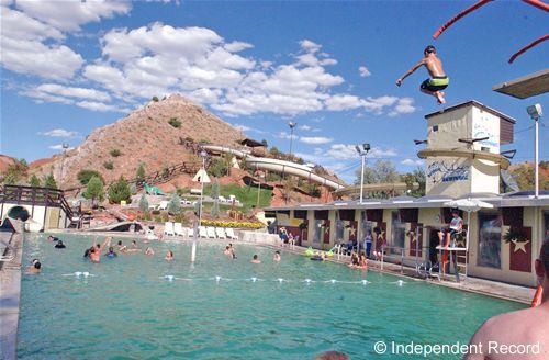
A new golf course is not far from town, a bowling alley located in downtown Lovell, and four ski areas are all within 90 minutes. Open to the public is an athletic complex in Lovel land includes a gymnasium, full-sized pool, racquetball courts, sauna and all-season track.
Hunting and fishing opportunities abound throughout the year. Big game and bird hunting is exceptional in the fall while fishing takes high marks during the year. Campgrounds can be found in Lovell, Pryor Mountain, Big Horn Mountains, Bighorn National Recreation Area.
HISTORICAL
This area offers many civic and social organizations to join. Clubs range from quilting, 4-H, Masonic Lodge, Rotary, Riding, Business and Professional Women's, Lions, Friends of the Library, Chamber of Commerce and many others a reactive in this community.
ML Ranch
Michigan born Henry Clay Lovell learned the cattle business in north Texas, the Indian Territory, and Kansas. A partnership was formed with Anthony L. Mason of Kansas City, Missouri, who financed the venture. Lovell provided the skill and knowledge necessary for the risky business of cattle ranching in what is now known as Big Horn County.
In 1879 they brought the cattle industry to the Big Horn Basin and established a ranch a few miles above the mouth of Nowood Creek. Lovell established a second ranch on Shell creek the following year, and in 1883, a third at the Five Springs site along the Bighorn River. This site became the headquarters for the ML cattle kingdom. The ML herd numbered as many as 25,000 cattle and roamed from Thermopolis north to the Crow Indian Reservation in Montana.
In 1888, the first mail service to the Lovell area was established as Cook's Road Ranch, with Josia Cook as first postmaster. The post office was named Lovell in honor of Henry Clay Lovell, who used his political influence to help provide the newly-settled area with the service.
Visitors to the site of the historic ML Ranch can see the original bunkhouse still standing and other remnants of the ranches past.
Caroline Lockhart Ranch
The Caroline Lockhart Ranch is just north of Barry's Landing in the Bighorn Canyon National Recreation Area. Caroline Lockhart ranched for almost 30 years, starting with 160 acres she ended up controlling more than 7,000 acres. This is the best surviving Dryhead country homestead. Lockhart was a newspaper correspondent, author and famous newspaper editor.
Writing for Boston Post, Philadelphia Bulletin and the Denver Post, Lockhart was a enterprising and investigative reporter. She wrote seven novels between 1911 and 1933. She combined a nostalgia for the cowboy before the close of the frontier, a dose of the reality of change and the introduction of strong female characters. Her heroines always exerted a moralizing influence over the rough cowboy heart, and in the end they always married happily.
Hillsboro
About 1903, Grosvener W. Barry chanced upon Trail Creek Valley and liked what he saw. After deciding to stay, be built a cabin and several other buildings from the dead timber on one side of the canyon. After a failing gold mining operation, Barry turned his place into a dude ranch where he bred and sold English hackneys. A post office was established at Hillsboro in 1915. Barry was appointed postmaster. Edith Barry operated the successful dude ranch for many years after Barry's death in1920. The main house burned down in the winter of 47-48.With the exodus of homesteaders during World War II, the post office closed in 1945.
Today one can see several buildings left and wander the area of the historic Hillsboro Dude Ranch only a short hike from the Barry's Landing parking lot.
Bad Pass Trail
American Indians camped along this trail years ago, and in prehistoric and historic time Shoshone used it to get to the buffalo plains. Early trappers and traders used it to avoid the dangers of the Bighorn River. You can see rock cairns left along the route between Devil Canyon Overlook and Barry's Landing. The trail is not open to hiking or driving in the Crow Indian Reservation, but sections an be followed in the National Recreation Area along the park road.
Also parts can be seen traveling through Pryor Mountain Wild Horse Range and and Recreation Area.
Medicine Wheel
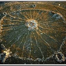
Atop the Bighorn Mountains, just off Highway 14A is one of the great mysteries of the world: The Medicine Wheel Archaeological Site, a legendary stone structure in the shape of a spoked wheel. Approximately 80 feet in diameter, the Medicine Wheel is somewhat isolated, lacking shelter, water, trees, and shrubbery. The Wheel's exact origins and its purpose have puzzled scholars for many years.
Perched atop the north side of Medicine Mountain, some believe the stone arrangement played apart in ancient religious ceremonies.
The site was designated a National Historic Landmark in 1970 and sits above the forest line at 9,642feet above sea level. Access can be gained in the summer via the Medicine Mountain Road, running north from U.S. 14A and taking off just west of the Bald Mountain Campground to a parking lot 1 1/2miles south of the site. The site includes an interpretive sign, restroom facilities, and a birds-eye view of the surrounding forest that is in itself well worth the trip. It is required that a person walk 1 1/2miles from the parking lot to the site. The area is handicap accessible.
RECREATIONAL AREAS
Bighorn Canyon National Recreation Area
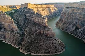
The Bighorn Canyon National Recreation Area is alive with geological, cultural, historic and scenic wonders. Highway 37 north (off U.S. 14A east of Lovell), follows the ancient route of the Bad Pass Trail, used by Indians and mountain men for centuries. The road passes through the Pryor Mountain National Wild Horse Range, providing opportunities to observe wild horses. One may also spy Bighorn Sheep, mule deer, coyote, pheasants and other wildlife along the drive. Opportunities for boating, fishing, water skiing, swimming, camping, hiking, picnicking, photography, sight seeing, and exploring historic sites are in abundance in the Recreation Area. There is a $5 entrance fee to the area. For more information on the Bighorn Canyon National Recreation Area contact the National Park Service Visitor Center 1-307-548-2251 or write to 20 Hwy. 14A East, Lovell, WY 82431.
Yellowtail Habitat
Located just six miles east of Lovell, the habitat management area extends from Bighorn Lake west up the Shoshone River to within three miles of Lovell and along the Bighorn River. The Yellowtail Wildlife Habitat Unit is managed by the Wyoming Game and Fish Department and the National Park Service primarily for upland game birds and waterfowl.
The 19,000 acre public hunting area displays what is probably the finest natural bird habitat in Wyoming. One can find many species of wildlife including white-tail and mule deer, ring neck pheasant, wild turkeys, chukkar and Hungarian partridge, bobwhite, quail, sage grouse, sharp-tailed grouse, mourning doves, Canada geese, mallard, teal and other waterfowl.
Access is available to the Bighorn Lake and the Bighorn and Shoshone Rivers. Anglers can find brown and rainbow trout, walleye, yellow perch, black crappie, channel catfish and sauger. Be sure to check the local hunting and fishing regulations for season and permit information.
The photographer of the family isn't left out in this area. More than 155 species of birds can be observed, big game animals, small mammals and their predators as well as several species of reptiles can found. Over 35 miles of roads and trails allow easy access throughout the habitat area and camping is permitted in most areas.
Devil Canyon Overlook
The Bighorn River plus 64 million years carved the chasm of the Big Horn Canyon. A deep and winding chasm with vertical limestone walls towering as high as 1,000 feet above the lake. At the north end, some mountain points rise over 2,000 feet above the water. No trip to Bighorn Canyon is complete without a visit to the Devil Canyon Overlook just north of the Horseshoe Bend turnoff. The overlook provides a breathtaking view of the confluence of the Bighorn and Devil Canyons atop cliffs that tower 1,000 feet above the lake level.
Bighorn Lake
Low water levels may prevent boat launching at some sites. Check with the National Park Service for details, 1-307-548-2251. In 1966 Yellowtail Dam in Montana was completed and thus created the Bighorn Lake. Boating enthusiasts will find plenty to see and facilities to serve them. With three main launching ramps water enthusiasts and fishermen have access to one of the prettiest and unique lakes around. At the south end of the lake not far from Lovell is the Horseshoe Bend boat ramp with its scenic red cliffs. Horseshoe Bend offers a marina and an outdoor boat storage area. The marina offers food and drink, fishing and boating gear and both Wyoming and Montana fishing licenses. There is a $5 entrance fee to enter the recreation area.
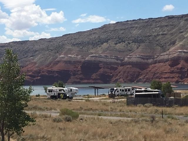
Horseshoe Bend features a camping area, amphitheater, fishing beach, fish cleaning station, group picnic site with playground, and swimming beach with lifeguard. (Check for time of lifeguard availability.)
Enjoy the short drive to Horseshoe Bend by driving east of Lovell two miles on U.S.14A then turning north on Highway 37.
A second spectacular boat launch area at the south end is Barry's Landing, north of Horseshoe Bend on Highway 37 past the Devil Canyon Overlook. Barry's Landing has a newly improved and widened boat ramp and there is primitive camping along Trail Creek.
At the north end of the lake is the Ok-A-Beh ramp. Included at the site is a new marina with foodservice and boat rental, comfort station and fish cleaning station. Gasoline is offered as well.
Pryor Mountains
The Pryor Mountains are a high, primitive wilderness area abundant in wildlife and rugged scenic views. The area is uncrowded and relatively untouched. . . even the campgrounds and picnic areas are purposely primitive. While some of the Pryor Mountain area is private land, including a portion of the Crow Indian Reservation, the public can enjoy some of the best scenery in the Custer National Forest, the Pryor Mountain Wild Horse Range and those portions of the area that touch the Bighorn Canyon National Recreation Area
The Pryor Mountains were named after Sergeant Nathaniel Pryor of the Lewis and Clark Expedition. The Pryor Mountain range is actually an extension of the Bighorn Mountains but is separated from the Big Horns by the Bighorn Canyon.
Accessing the Pryor Mountain area is no real problem in summer. Some of the roads are graveled and graded. There are several ways to access the mountain. . . .
Drive south past Bridger, Mont. on U.S. Hwy 310 turning east after crossing the Clark's Fork River.
Drive northeast from Warren on a gravel road, turning east shortly after the road enters the Crow Reservation. Take the airport road north out of Cowley, which turns into the Crooked Creek Road. Take one of the two four-wheel-drive roads off Wyoming Highway 37 near the south entrance to Bighorn Canyon National Recreation Area.
The Pryor Mountains contain a number of caves, some of which are large enough to explore. Caves can be very difficult to access and dangerous to navigate. Contact the BLM or the Forest Service for information on the caves, permits and accessibility.
Dryhead Overlook provides an eagle's eye view of Dryhead Creek and the Bighorn Canyon. A 4,000foot drop is a part of the sightseers' breathtaking panorama. On clear days sightseers can see as far as Billings and Hardin, and the red dirt and rock make it a colorful scene.
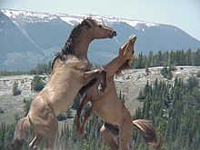
Wild horses may be glimpsed in the Pryor Mountain Wild Horse Range, an area set a side in 1968and managed by Bureau of Land Management. Today 150 to 180 horses roam the range freely.
SCENIC DRIVES/TRAILS
Big Horn Mountains
DID YOU KNOW?
The Big Horn National Forest is the 3rd ranked destination point in Wyoming for non-residents behind Yellowstone and Grand Teton National Parks.
It's also the 4th ranked destination point for residents behind, Yellowstone, Grand Teton, and the Medicine Bow National Forest.
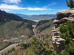
Heading east out of Lovell on U.S. Highway 14A, crossing through the Bighorn Canyon National Recreation Area, visitors are struck by the rugged beauty of the steep walls and rugged canyons of the Bighorn Mountains. Within 25 miles of Lovell, the road begins to climb, becoming one of the most spectacular pieces of highway in America with turnouts and scenic vistas that look out over the entire Big Horn Basin and the Rocky Mountains. On a clear day, a traveler can see for over a hundred of miles. U.S. 14A has been designated a Scenic and Historic Byway by the United States Congress.
This modern highway was constructed using engineering methods developed in France and first employed in highway construction in the Alps. This technical and engineering marvel has opened some of this country's most beautiful mountain county to tourist travel.
Outstanding scenery includes mountain peaks, forest and meadows as well as canyonland, streams, waterfalls, lakes and a variety of wildlife from the largest moose and elk to smallest chipmunks and squirrels.
Porcupine Falls Trail
Do you like to hike?
A favorite is the hike down to the bottom of the beautiful, 200-foot Porcupine Falls on the Big Horn Mountains, which roar down into a large pool. Scenery, fishing and solitude await those adventurous folks. Bucking Mule Falls Trail
An 11-mile trail leading from a parking lot at the end of Devil Canyon Road (north of U.S. 14A) to the roaring 550-foot bucking Mule Falls, looping back again south to the end of Jaws Road below the Porcupine Campground. ( A shorter version of the hike, 1 1/2 miles to the falls and then back maybe taken.) The trail, an easy walk, perfect for families, skirts the rugged rims of scenic canyon land and takes the hiker from thick, lodgepole pine and Engelman spruce stands to overhanging ledges gazing down to the the crashing falls below. The trailhead includes restrooms, water, a horse-tying rack, and trailer and vehicle parking. Five
Springs Falls Trail
Five Springs picnic ground and campground is located 25 miles east of Lovell on old U.S. highway14A and includes a beautiful nature trail to Five Springs Falls.
Pryor Mountain Wild Horse Range
Primitive Mustang Markings: Dorsal Stripe; Tiger Stripes; Cross on withers;
Pointed black rimmed ears (inside fawn colored)
Bar or dark V on withers
Dorsal Stripe
Tiger Stripes
Dark Rimmed Ears
Cross
Wild horses have long roamed the Pryor Mountains. Mustangs are traced to the Spanish Conquistadors of the early 1500s when horses that escaped or were abandoned became the nucleus of the wild herds. Later they became mounts for Indians and pioneers. Although wary of humans, the Pryor mustangs graze openly in the high elevations. They spend much of their time in almost inaccessible box canyons used only by themselves and a few deer, then move up the high ridges, traveling in small bands of individual harems - a group of mares and younger horses with one stallion in charge. Colors in the Pryor Wild Horse herd are outstanding - one finds roan, black, sorrel, blue, tan, mouse buckskin and the grullas. Dark manes, tails, lined backs and tiger-striped legs suggest a return to the original species of Andalusian Mustang or Spanish Barb.
These horse, seen in the grandeur of the natural settings, unfettered and unrestrained, preserve a segment of our historic heritage for future generations and are a living symbol of the American dream of freedom.
In 1968 the Secretary of the Interior set a side 31,000 acres of public land on the Montana-Wyoming border to create the Pryor Mountain Wild Horse Range. It has since been expanded to about 44,000acres.
Visitors can very often see and photograph the wild mustangs along the Highway 37 in the Bighorn Canyon National Recreation Area. Or they may be viewed grazing in meadows atop the Pryor Mountains. The closest route from north Big Horn County is the Crooked Creek Road (airport road)north of Cowley. A four-wheel drive vehicle is recommended. For two-wheel drive vehicles, the Pryor Mountain Road out of Warren, Mont. is easiest and best and also takes visitors to some nice campgrounds along Sage Creek.
For information you may visit the Pryor Mountain Wild Mustang Center website at www.pryormustangs.org.
SPORTSMEN
Hunting
Whatever you fancy from sage grouse to Shiras Moose, there are some excellent hunting opportunities in Mustang Country. Action for the bird hunter begins in September when doves from further north migrate into the area around Lovell to join what is often substantial population of resident birds. Upland game bird action in North Big Horn County begins just about the time the majority of the doves have headed south on the first chill winds of fall. The giant-sized sage grouse, second in size for upland species only to the wild turkey, also come into legal season in the early fall.
Don't forget the Canadian geese and possibly one-of-the-best pheasant opportunities around. Looking for something a little larger? White-tail deer, mule deer and antelope seasons open in late fall. With elk and moose seasons also opening in the Bighorn Mountains. From September to December the avid hunter can be busy every single day. Be sure to check for season dates, quota sand other pertinent information before going into the field. Information can be obtained through the Wyoming Game and Fish Dept.
Fishing
Fishing opportunities in north Big Horn County really never end. From the eager fishing trips of spring, to the lazy days of summer, to the quiet isolation of those hardy ice fishermen, there's year-round opportunity to "catch the big one" in this recreation paradise. The scenic shores of Bighorn Lake provide a marvelous backdrop for walleye and sauger fishing. A largely overlooked source of action is channel catfish. There are some real monster cats in the reservoir, so plan to take your heaviest tackle and do some night fishing.
Other species found in Bighorn Lake are rainbow, brown and some lake trout; a few large mouth bass; crappie, yellow perch, green sunfish and ling, most often caught in fall and winter.
A popular local place for family fishing is Deaver Reservoir. This small impoundment is stocked with trout and walleye by the Wyoming Game and Fish Dept. Located just west of Deaver, which is only12 miles northwest of Lovell. Pond Five in the Yellowtail Habitat Unit east of Lovell is also a popular fishing spot for kids and families, featuring trout, largemouth bass and sunfish.
For those who prefer a higher altitude, the Bighorn Mountains offers numerous small streams, pond sand a few lakes for excellent trout fishing. Be sure to obtain valid fishing permits and check for restriction, limits and other guidelines before going out.
Snowmobile
The Bighorn Mountains offer 391 mile of snowmobile trails for the cold-weather adventurer. In the north 193 miles of well-marked and groomed trails with an additional 22 miles of ungroomed trails exist for the machine extreme. Fast, food and lodging are available in most trail area, complete facilities and services are available in Lovell, Greybull and Sheridan. Snow depth vary from 1 to 10feet with elevation ranging from 7,500 to 10,000 feet. While the season runs November to April, the peak is January to March. Snowmobile rentals are available at Wyoming High County Adventures, Lovell. User fees are required by Wyoming State Law. Licensed permit selling agents are Minchow's Service Station, Wyoming High Country Adventures, and Country Store all in Lovell.
Bicycle/Hiking
Plenty of trails exist for the hiker and cyclist. The Bighorn National Forest offers outstanding views of the mountains and forest. Wild flowers abound in the forest and deer, elk and occasionally moose can be sighted along with many species of small wild animals and birds. One can find unmatched scenic and solitude along the many miles of forest trails in the back county. Bucking Mule Fall National Recreation Trail is an 11-mile trail leading from a parking lot at the end of Devil Canyon Road to the roaring 550-foot Bucking Mule Falls, looping back again south to the end of Jaws Road below the Porcupine Campground. This trail is an easy walk perfect for families. Always be smart when heading out, dress appropriately, the weather changes quickly and sometimes drastically, be sure to let someone know where you are headed and your expected time of arrival and don't forget the camera.
Boating
In the Bighorn Canyon National Recreation Area there are three main launching ramps. At the south end of the lake not far from Lovell is Horseshoe Bend boat ramp. Horseshoe Bend offers a marina, outdoor storage area, food, drink, some boating/fishing gear, fuel and Wyoming and Montana fishing licenses. (Be sure to watch those state line boundaries when fishing!) Horseshoe Bend also offers camping, fish cleaning station, picnic sites, swim beach and beautiful red cliffs. The Horseshoe Bend Marina is currently closed due to drought conditions.
Barry's Landing boat ramp is north of Horseshoe Bend on highway 37 past the Devil Canyon Overlook turnoff. Newly improved and widened, one will find limited camping spots and a large parking area for vehicles and trailers. No concessions are available here. Trail Creek Campground offers limited camping sites.
The north end of the canyon is Ok-A-Beh, the third boat launching area. Full concession services are available in the summer..
Low water levels may prevent boat launching at some sites. Check with the National Park Service for details, 1-307-548-2251.
Camping
Five Springs picnic ground and campground is located 25 miles east of Lovell on old U.S. Highway14A and includes a beautiful nature trail to Five Spring Falls. Newly rehabilitated Bald Mountain Campground (16 family sites, including handicapped sites) and Porcupine Campground (12 sites)are located 35 miles east of Lovell on new 14A. Porcupine campground is situated a short distance off the highway, near the Medicine Wheel Ranger Station. Both offer water, fire grates, out houses and trash pickup. There is a $10 use fee per night.
Horseshoe Bend features a camping area, amphitheater, fishing beach, fish cleaning station, group picnic site with playground, and a swimming beach.
Sites are available year round. Some sites have shade shelters and modern flush toilets, drinking water and RV dump station is available in the summer. You can get to Horseshoe Bend by driving east of Lovell two miles on U.S. 14A, then turning north on Highway 37. There is a $5 entrance fee to enter the Bighorn Canyon National Recreation Area. Farther north in the recreation area is Trail Creek Campground offering primitive camping near Barry's Landing boat ramp. This site has only 5 tent-only sites and 7 tent or trailer sites.
The Town of Lovell also offers camping within the town limits. Water, sewage dump and showers are available.
Golfing
Be sure to bring your clubs and try out the Foster Gulch Golf Course. Located southwest of Lovell on Lane 13, Foster Gulch is open daily, with special rates for weekends and holidays. Single, family memberships are also available. Cart rentals are available and new driving range is open. Call 307-548-2445 for more information. Choose this theme to customize and add content to this page.
